Upon reading Alatout's article about some of the sociospatial implications of the wall that separates Israel the West Bank as a "technology of government in practice" (p. 958), I was reminded of the time that I spent living and working in Palestine during the summer of 2015. Though conditions in Israel/Palestine change quite frequently, I wanted to offer some brief observations about how Israel's spatial technologies of occupation have evolved from the time of Alatout's observations between 2004-2006 and my own in 2015.
I should pause to say that my own research examines how law structures the spatial realities of occupation in Israel-Palestine and how some anti-occupation activists in Israel push back on these technologies of oppression and domination. My current thesis examines the work of an organization called MachsomWatch (CheckpointWatch), an Israeli women's volunteer group made up of primarily secular, Ashkenazi Jewish women who monitor the checkpoints between Israel and the West Bank and the Israeli military court system that has authority Palestinian residents of the West Bank.
In many ways, these two technologies of occupation, physical barriers (which include internal checkpoints as well as the main apartheid wall) and military courts, act as the two pillars of the Israeli occupation of Palestine. While the physical barriers "mark certain bodies with illegality," the military courts bring the force of the law to bear on those bodies (Alatout, 2009, p. 963). Alatout emphasizes how the separation wall acts as a technology of government to construct a regulatory framework for controlling all spaces and people in the West Bank (p. 967). While it is easy to make the assumption that the main wall pictured in Alatout's article operates as the primary physical barrier organizing the socio-spatial relations between Israel and the West Bank, there are many internal technologies of government that further segregate the West Bank and determine who has a right to freedom of movement. No where are these technologies more visible than in the Southern West Bank city of Hebron (al-Khalil).
Hebron is a microcosm of the occupation. Nowhere else in the West Bank is there such close contact between settlers and Palestinians. Nowhere else in the West Bank is there a building split down the center to serve as a mosque and a synagogue. Nowhere else in the West Bank did I witness such obvious evidence of the consequences of occupation, for both Israelis and Palestinians.

Graffiti in the Old City of Hebron that reads “Welcome to Palestine” and has been crossed out.
Hebron is also a city with religious significance. Timelines from the Jewish, Muslim, and Christian traditions differ on the founding of the city and which groups historically had control over it, but all three religions acknowledge it as a holy place. It is believed that Abraham, the father of all three religions, lived there around 1800 BCE.
The modern history of Hebron is even more contentious. The first Israeli settlements were established in the city shortly after the Arab-Israeli War in 1967. In 1997 following the Second Intifada, Hebron was split into two areas: H1 controlled by the Palestinian National Authority and H2, under Israeli control. The city has seen more violence than most places in Palestine because of this unique partitioning.
 A view of a settlement from a Palestinian home in the Old City of Hebron
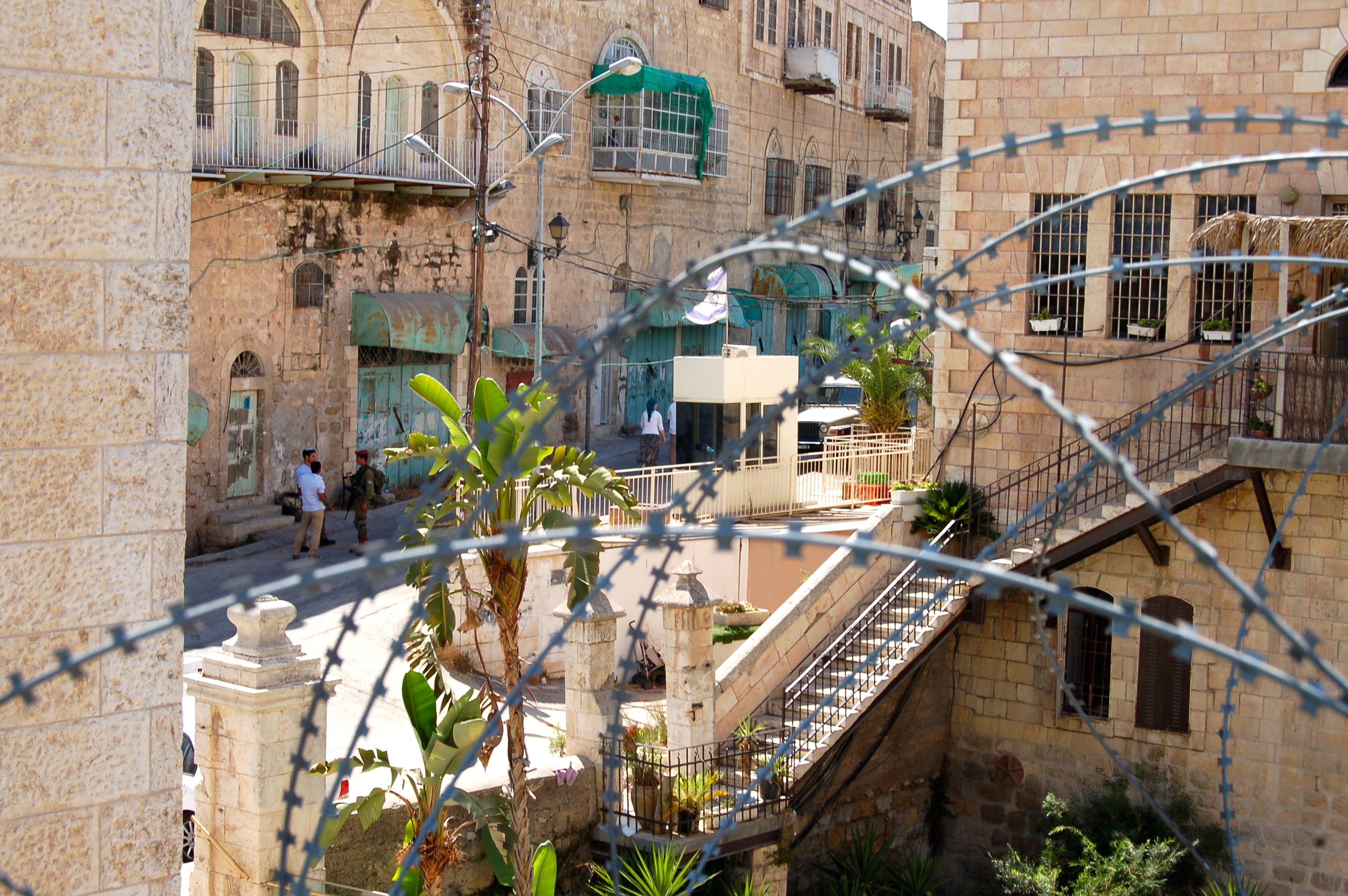
The settlements in Hebron are unlike those anywhere else. The entire Old City is part of H2, although there are still tens of thousands of Palestinians living there. 650 Israeli-Jewish settlers live among the Palestinian population, or more accurately above the Palestinian population.
Settlers literally live above Palestinians in the Old City. Palestinians are only allowed to live on the first floors of buildings, and settlers live above them. Barbed wire, tarps, and fencing vertically divides the two populations and help to protect Palestinians from garbage and debris thrown upon them by settlers.
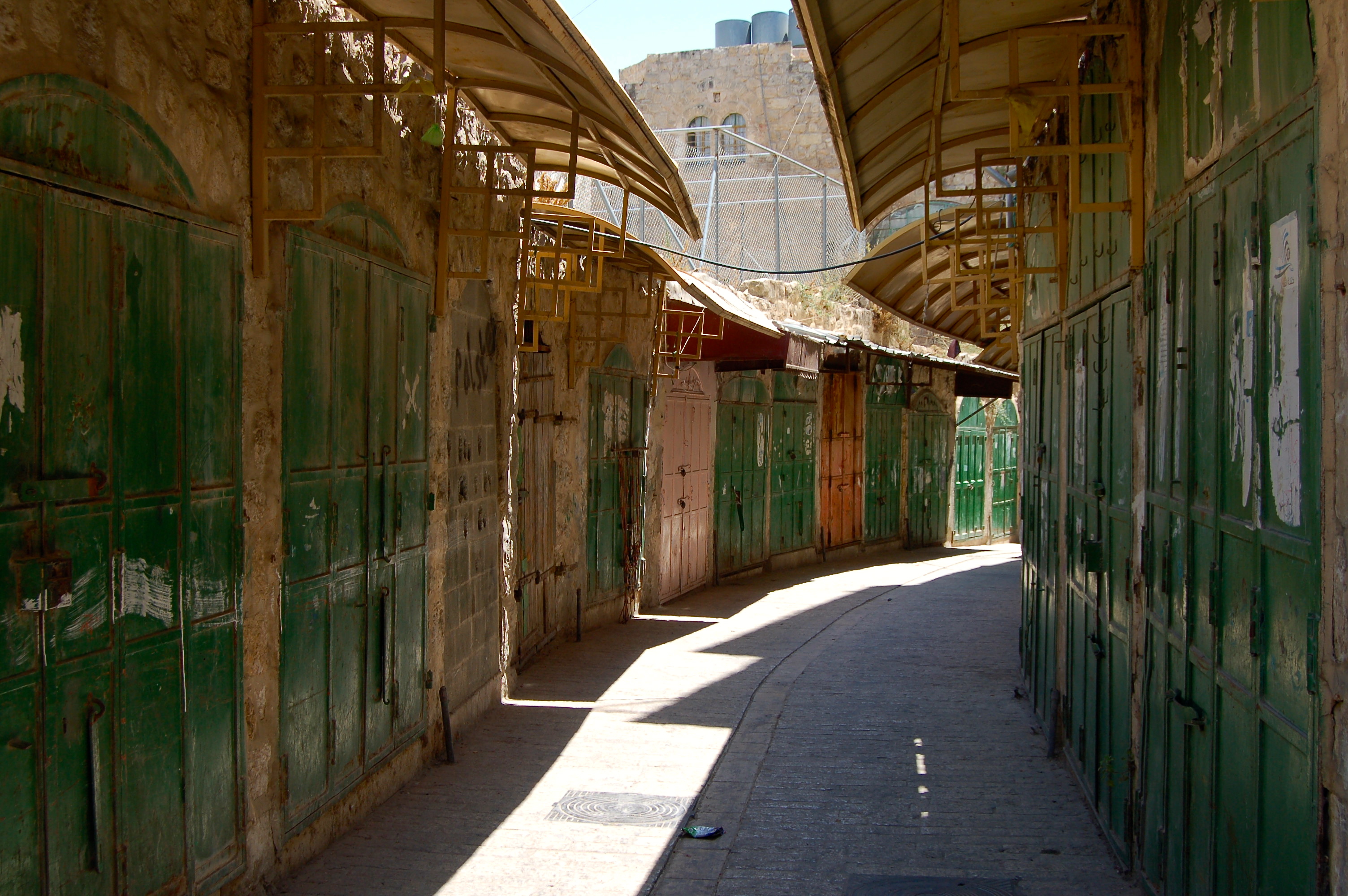 |
| A street in the Old City that is now virtually deserted - these shops were forcibly closed by Israeli soldiers. |
The settlements within Hebron are surrounded by Palestinian neighborhoods that appear deserted. Almost all of the shops are boarded up and many homes remain empty. Shuhada Street is the largest of these closed down streets. This once-thriving commercial center has been turned into a ghost town. Many Palestinians refer to this street as “Apartheid Street.”
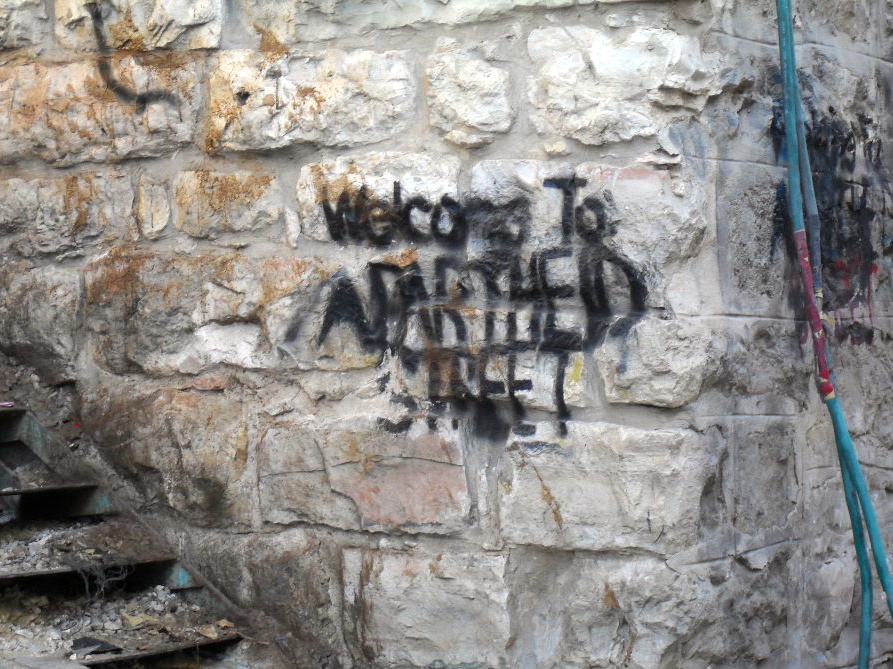
Graffiti near Shuhada welcoming visitors to “Apartheid Street”
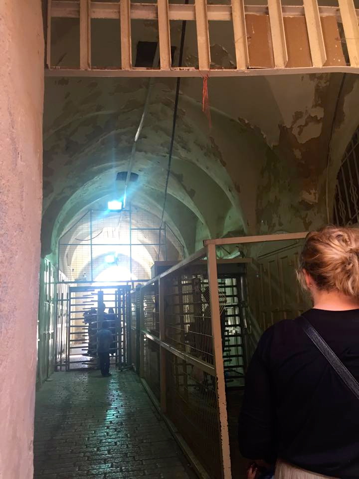 |
| Crossing through one of the internal checkpoints in the Old City |
Shuhada Street and the neighborhoods that make up the Old City are all oriented around a central building,the al-Ibrahimi Mosque/Tomb of the Patriarchs. There are over 20 checkpoints in the 1km area surrounding the building. They separate settlements from Palestinian neighborhoods and isolate neighborhoods from one another. Legally, Israeli soldiers are allowed to detain individuals at each checkpoint for up to three hours, which means it could take days just to walk down the street.
This building marks the central holy site in Hebron and sits above the place where Abraham, Sarah, Isaac, and Ishmael are believed to be buried. The mosque was also the site of a massacre in 1994. A settler came into the mosque and opened fire on people inside praying, killing 29 and wounding over 100. It was after this massacre that the site was partitioned and a synagogue was created that now takes up 60% of the building. These technologies of government, the settlements, checkpoints, and divided holy site at the center of Hebron, further demonstrate the realities of the kind of restrictive spatial power that Alatout describes in his article. At the core of these technologies are contested meanings of place that provide perhaps one of the most extreme examples of how these contestations can manifest as very real consequences for the rights and freedoms of people living in these spaces.
I found your entry on Israel extremely interesting. As Americans, we are taught to treat Israel with a certain amount of respect and reverence. However, discussion about the way Israel treats the Palestinians in the settlements is not usually discussed in contemporary American discourse or politics. The settlements and checkpoints you describe in your blog post sound so cruel and inhumane, such as the Israeli settlers literally living above the Palestinians, who dump trash and debris onto those below, so much so that the Palestinians have had to construct fencing to protect themselves. I feel as though things like this do not get talked about because of their highly charged politicized nature. And, if you do dare to speak about these injustices that are occurring in Israel, you are labeled anti-Semitic by a certain subset of the population. I am glad that someone wrote a post about at least some of the issues that occurring in these settlements, as they are not discussed nearly enough in every day discourse. The country has a huge military technology industry, primarily for reasons relating to Palestine that you mentioned in your post. The article Alatout wrote does a great job of explaining exactly what these technologies look like and what day to day life is like for the people who live there.
ReplyDelete